Sweden's first supermodel and the actor David Niven's second wife
In search of Lo Scoglietto 2023
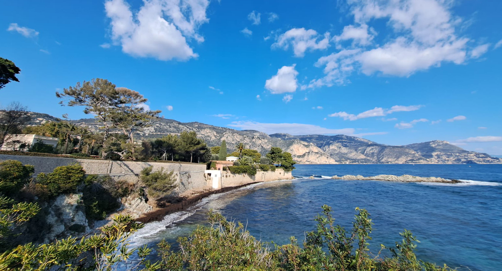
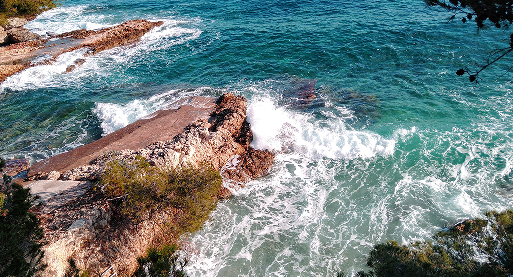
View from the coastal path, looking towards “Fleur de Cap” (Lo Scoglietto). Cap Ferrat, January 2023.
During a short city break to Nice in January 2023, I persuaded my family to join me for an adventure to find the Nivens’ house at ‘Lo Scoglietto’. (It’s now called ‘Fleur de Cap’, but I’ll use its old name on this page).
We hopped off the bus in the small town of St-Jean-Cap-Ferrat, on the northeast side of the Cap Ferrat peninsula. (I’d always imagined ‘Lo Scoglietto’ to be on the southernmost tip for some reason).
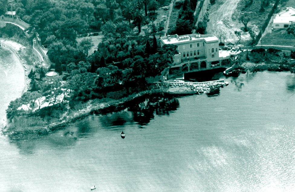
I doubt the house would have been difficult to find, but we still asked directions from a group sitting outside a cafe, one of whom happened to be the local mayor (!) They pored over an old photo (see below), eventually recognised the location, and explained that “It has changed a lot.” A short stroll northwards was suggested.
[Karma would be them finding me relaxing in my hometown on a Saturday morning, showing me a 60-year-old aerial photo on a mobile phone, and hoping for instant recognition.]
Lo Scoglietto, 1964. The coastal path to the left still leads from St-Jean-Cap-Ferrat, winds inland around the back of the house, and then continues beyond what is now ‘Place David Niven’ (where the cars are parked), to Beaulieu-sur-Mer.
The main differences in 2023 are not the buildings, but more the surroundings. What looks like a field covered in tracks (to the right of the house) is now a road with a line of houses. That’s now the inland route to ‘Place David Niven.’
The path to the Cap
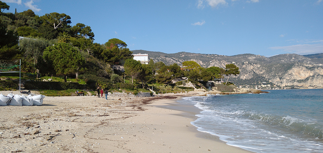
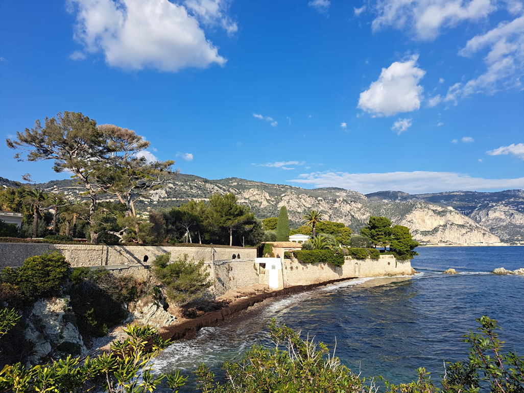
We decided that the coastal route would be the most scenic. Stepping off the main road through St-Jean-Cap-Ferrat, there is a beautiful (and very new-looking) marina leading to a small beach I’ve never seen mentioned by either Niven and a coastal path.
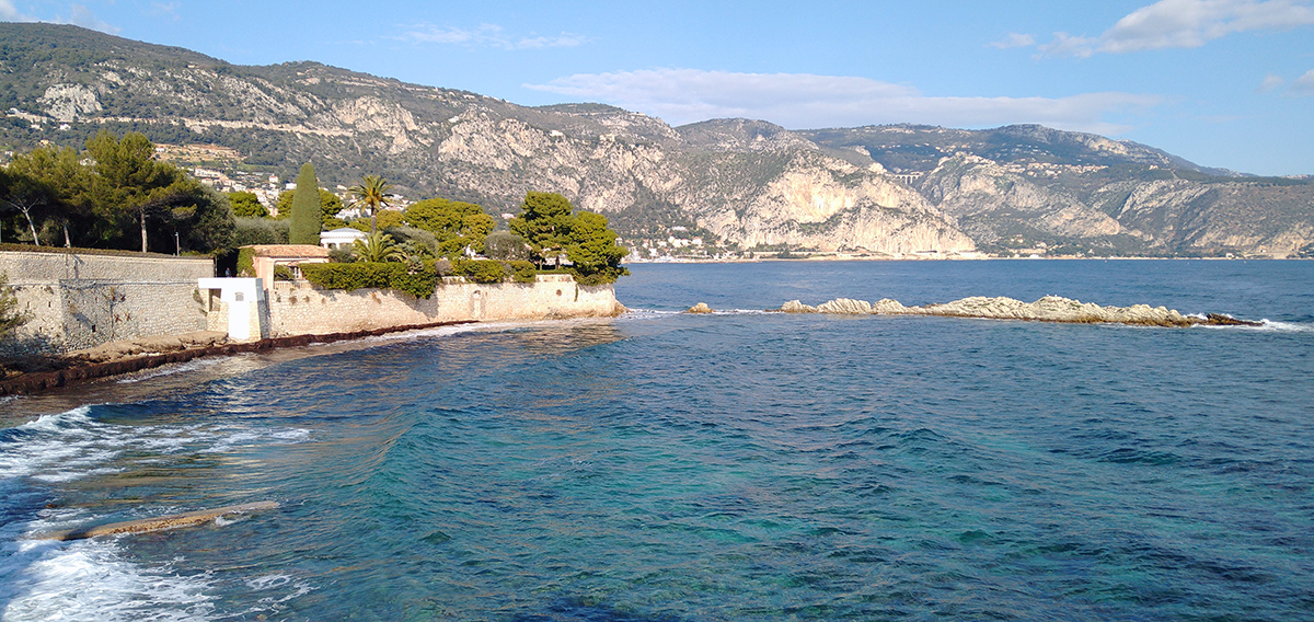
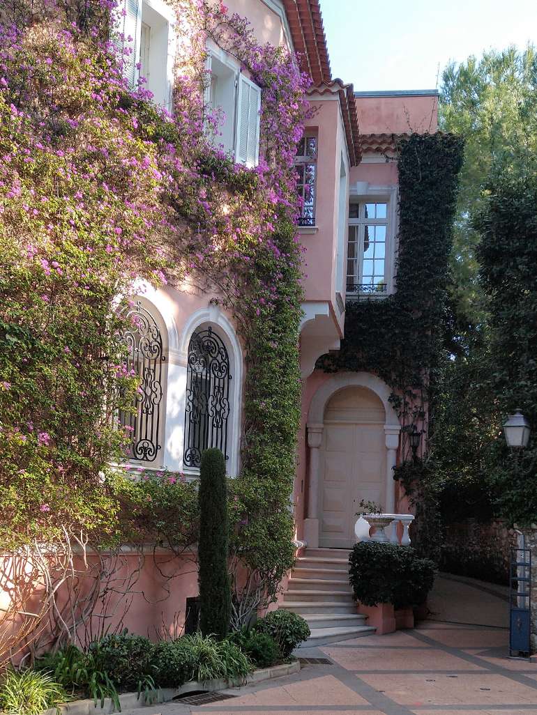
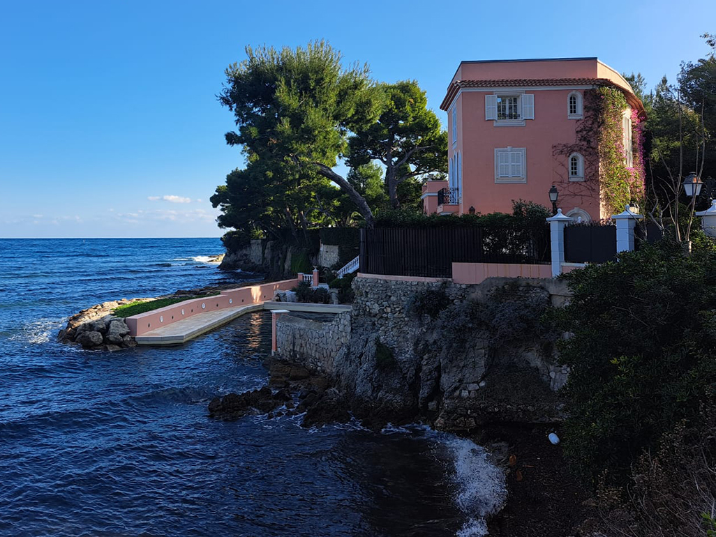
The beach at St Jean de Cap Ferrat, looking northwards towards the path to Lo Scoglietto. The beach looks pleasant enough, especially considering this was in January. We had an outdoor lunch an hour after the walk, but needed jackets and scarves.Following the path. The white protrusion, from the sea wall in the middle distance, is a viewing platform that marks the start of the Nivens’ old territory. The rotunda is just visible. In front of it is probably Hjordis’ “beach house”. The line of rocks leading into the Mediterranean is where Charlie Chaplin and his family were pictured during a holiday in 1957:Embed from Getty ImagesThe “clear green water” of the Mediterranean near ‘Lo Scoglietto’. The photo looks colour-enhanced but really isn’t. In fact, the photo does no justice.Further along the approach to ‘Lo Scoglietto’.The path turns inland at the white viewing platform, running alongside the garden walls of ‘Lo Scoglietto’ towards the front of the house itself. The ancient olive trees described in 1977 are something to behold: “The Niven principality has 2000-year-old olive trees once recorded in a Roman assessment of local wealth.” The walls are actually built around them.Arrival at ‘Place David Niven’, looking back towards the ‘olive tree path’ and Lo Scoglietto’s front door. The house looks as exotic as ever, painted pink to avoid discolouration from Sahara winds.
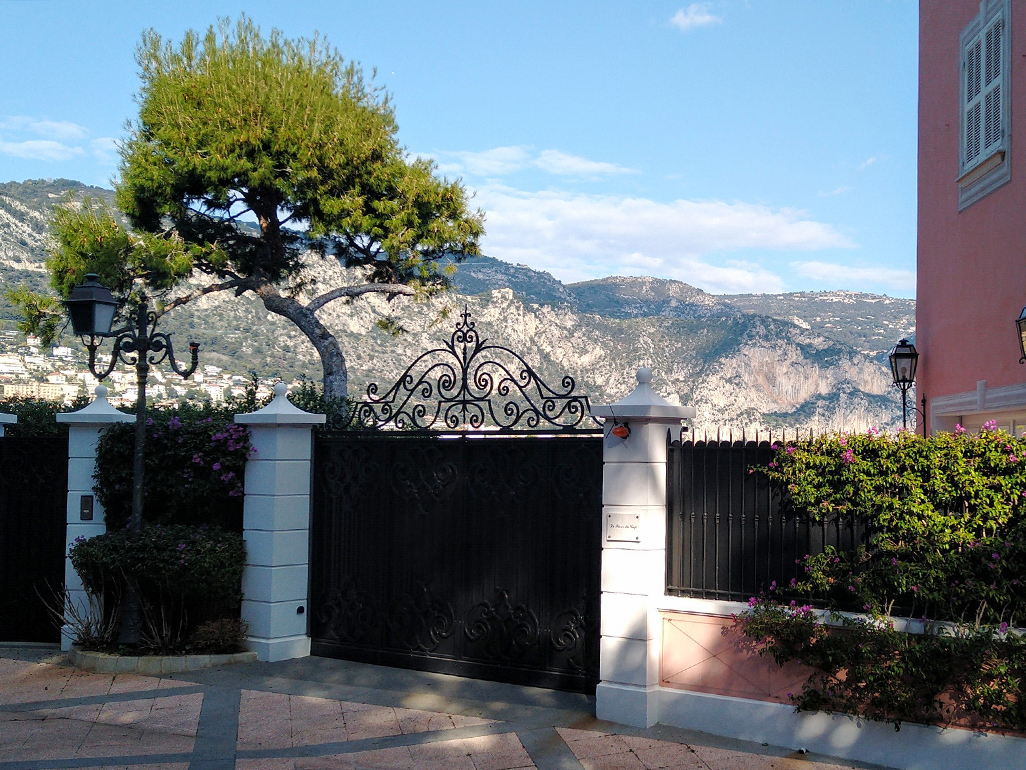
‘Place David Niven’. The name plaque is opposite the house.
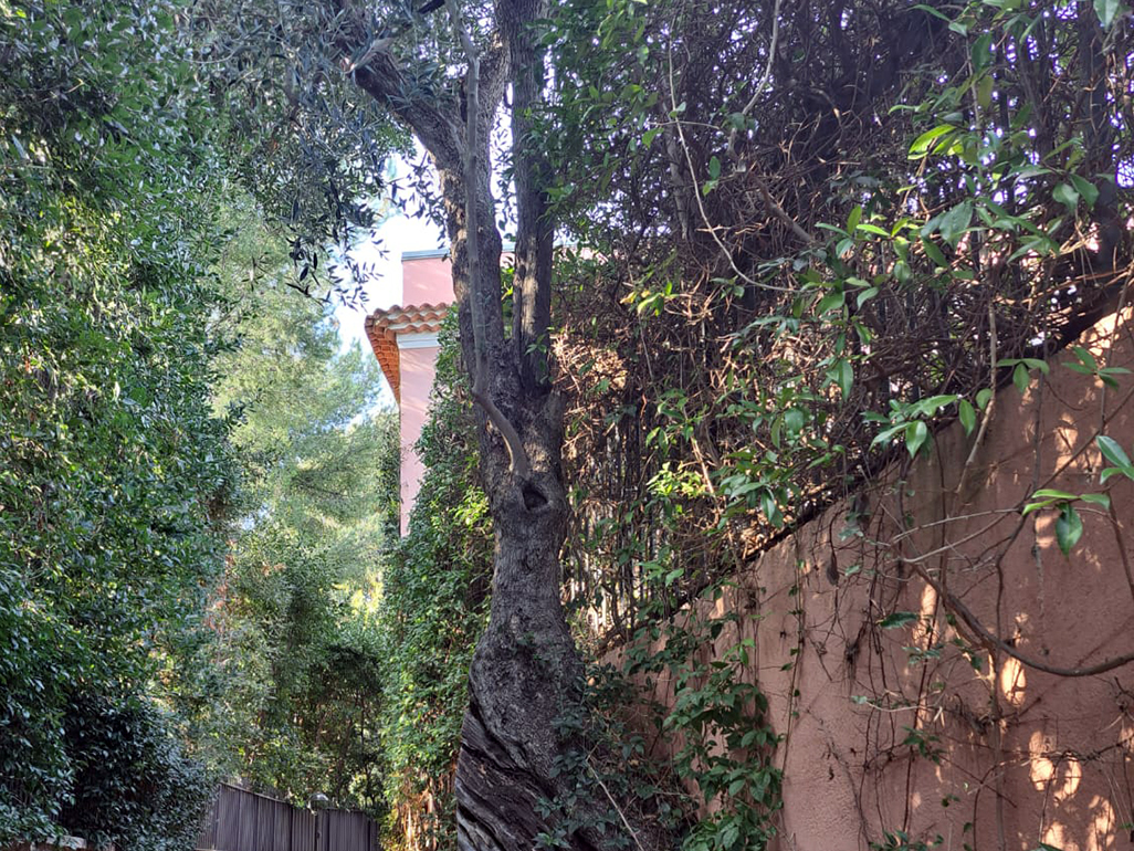
The side of the house
A look at (but not over) the garden gate, with mountains visible across the bay.A last glance back at the house, with its private harbour. Viewed from the path as it continues towards the beach at Beaulieu-sur-Mer.